May 23 thru 25, 2020
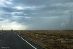
We ventured out for the holiday weekend. Opting to stay relatively close, we went to the west desert of Utah again. Fortunately, a front was planned to pass through Utah on Friday afternoon and evening and make temperatures very pleasant in the desert for this time of year. Leaving Friday afternoon after packing up the van we got passed Nephi and started to hit some gusty winds and foreboding looking clouds. The clouds turned out to be a dust storm and not much rain. Driving wasn’t too bad though it was a bit dark and the cross gusts kept me alert at the wheel.
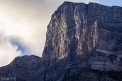
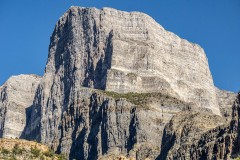
Last year we drove near this area of the desert on our Ibex weekend. Notch Peak is a relatively little known limestone peak. What’s notable is that it is the second tallest cliff in the lower 48, El Capitan being larger. The peak has a ominous dark grey appearance in a narrow looming cirque. Being in the basin and range area of the country it means that there are wide open basins of desertland making the peak have significant relief—about 4600′ from our camp spot.
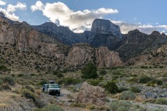
Pulling into West Sawtooth Canyon we opted to take the camping spot just before dipping into the wash. The road gets rougher here and since it was stormy we didn’t feel like having to manage any gnarly road in the weather. This spot also had the benefit of a great view of the peak, unlike the camping zone at the end of the road a half mile further.
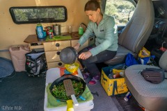
We got to test out the fully indoors cooking setup in the Express as well. With the weather blowing and dusty outside we were able to cook comfortably inside the van on the newly finished kitchenette. We are still getting used to the new space and where to put all the little things. I’m sure we’ll be refining things for a while in this respect.
Making breakfast the next morning we were able to see the swirling clouds from the tail end of the front. This provided for a nice time lapse. Next time I do one of these I’ll remember to do the panning and zooming stuff for a little more visual interest.
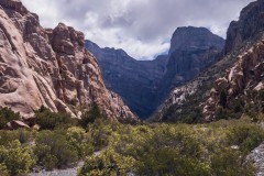
Climbing Notch Peak is a serious affair, not one that Carly and I would consider. The routes are long, difficult, and are more dangerous than routes we do. We were here to explore the granite crags in the canyon leading to the peak. These crags are infrequently visited but hold some good climbing, though much of it a little harder than we currently are climbing.
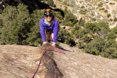
One of the features typical of this area are intruding dikes of rock in the granite. Two of the interesting climbs we did were on features like this. The first was a purely sport route on narrow, but sharp and usually positive holds. The other route was a 5.6 slabby route which follows a long dike for about 75m. The slabby one being fairly run out but easy. Our lack of climbing lately has made us weak and we only got few pitches in each day, which was OK because the surroundings were great.
Monday we opted to drive to the other side of Notch Peak as we’d read there is a hiking trail that goes to the top. From our vantage point at camp it appeared that the cliff terminates at the summit, a very dramatic feature. We were hoping to hike to the top to see if the cliff did in-fact go right to the summit.
I’d downloaded the off-road maps for the area prior to leaving so we were able to navigate to the trailhead after about 1.5-2 hours of driving on a combination of paved and dirt roads. The non-technical trail is on the east side of the mountain and we’d camped on the west side.
Surprisingly there were about a dozen other vehicles in the parking lot. The peak isn’t well known, even in climbing circles, and is 10 miles from the main road, sections of which require moderate ground clearance and perhaps AWD. While I’d downloaded a number of different maps for the area none indicated the trail to the summit. Our reading about it had mentioned it is fairly straightforward though.
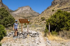
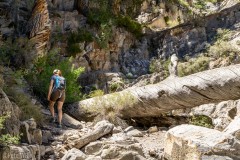
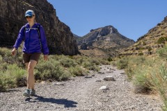
The cloudless day turned out not to be uncomfortably hot. Even in the narrow canyon wash we had a breeze keeping us reasonably comfortable. The trail starts in a gravelly wash which is loose, but nearly flat. This continues for a couple miles and the wash narrows into a canyon with some tall walls on either side and trees to offer shade. Around 2.5 miles the wash gets very narrow and rocky requiring scrambling up a couple steps. At one point there is an enormous pine tree which has broken off and fallen over. The trail goes around the still standing portion of the trunk and it must be at least 6 feet in diameter. The grade increases after this point. After this the wash peters out and we were left on the slope leading to a saddle with Notch Peak very unimpressive looking on the left and another peak to the right. This side of the mountain is relatively benign terrain with a mostly gentle slope leading to the summit.
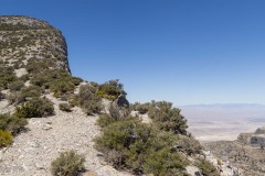
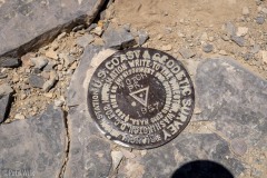
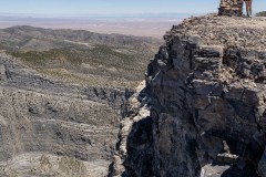
Getting to the saddled you get the first view of the cirque and the cliffs that we’d seen from our camp. The impressive north face does indeed terminate right at the summit—quite an impressive work of geology. The trail winds its way towards the summit from the saddle along the cliff edge, though set back for comfort. The short slog to the summit is over in 400 vertical feet or so. A summit cairn is built just a few feet away from the cliff edge.
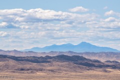
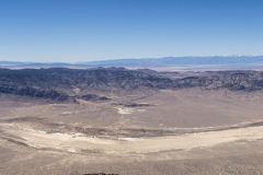
We soaked in the views, had some lunch, and took some pictures. Utah is such a beautiful state with amazing variety in all seasons of the year. Looking west about 50 miles we could see Wheeler Peak in Nevada in Great Basin National Park, still with snow on it. This is another area we’re looking to go visit again since our last one was rained out. We retraced our steps, correcting a slight off-trail mistake on the way up, and made it back to the car in late afternoon to share a beer and start heading back to SLC.
PS I can’t figure out why it is called Notch Peak. There’s no notch as I can think of in the peak. The only thing I can figure is that the whole cirque to the north of the peak which creates the dramatic narrow canyon might be considered a ‘notch’ but I’m not sure.

